Whitehall Conservation Area
Location
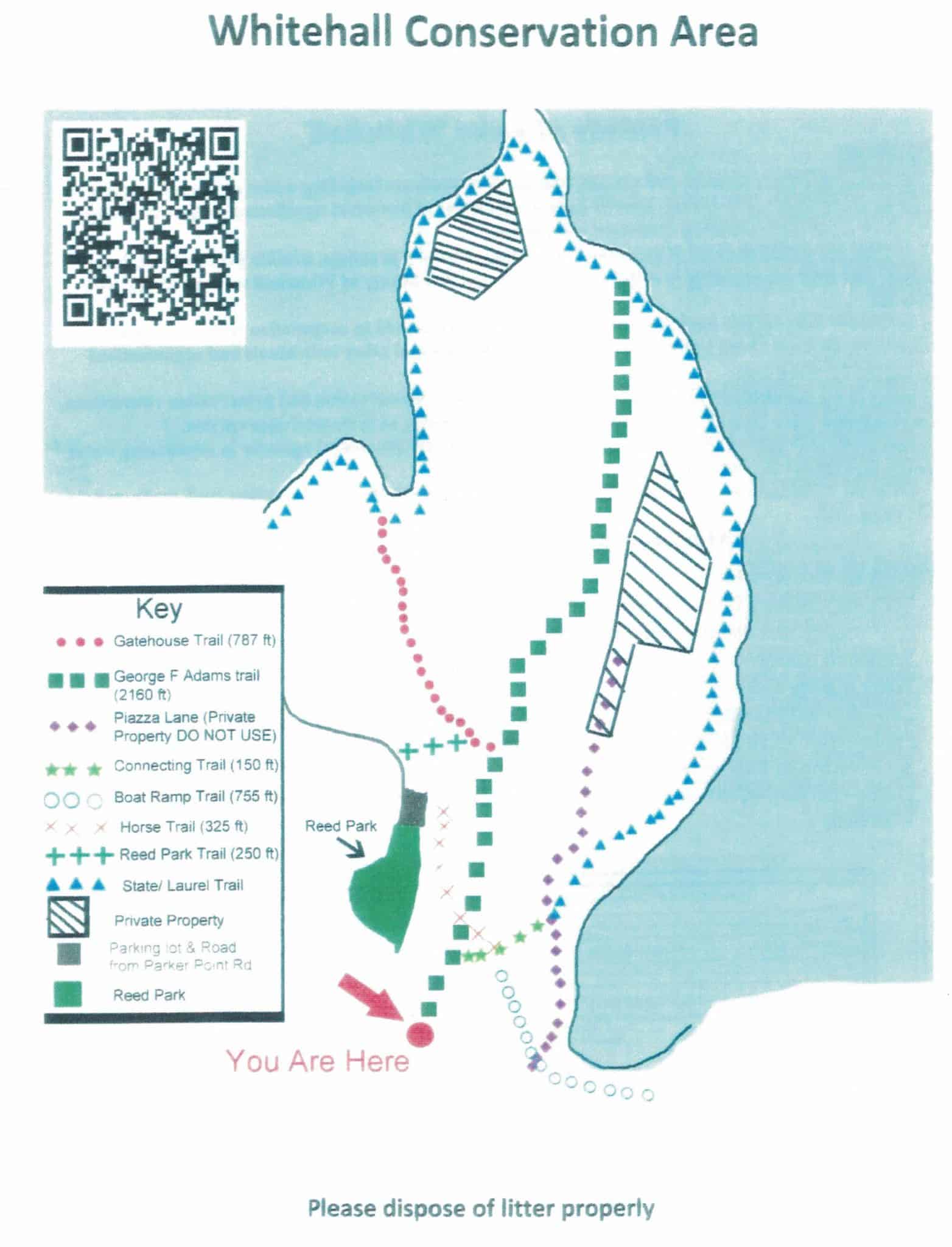
Map Legend

Whitehall Conservation Area Map
Click map for larger view
Directions
The entrance is located on the south side of Wood Street, just east of the Lake Whitehall parking lot. If heading west, turn left just after the property sign. The entrance is a large park-like area and is plowed in winter. Park on the grass after driving in, before the gate. The trail is the “Spine Road” behind the gate.
Overview
This property is adjacent to Whitehall State Park and Hopkinton’s Reed Park, both easily accessed from this property.
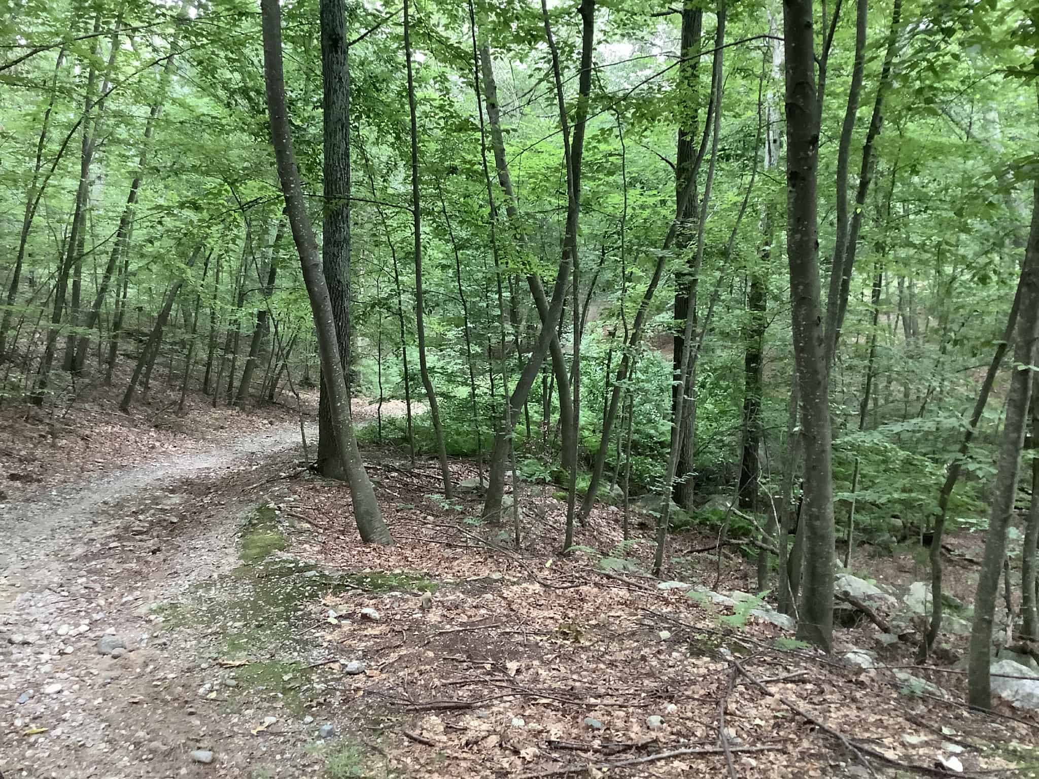
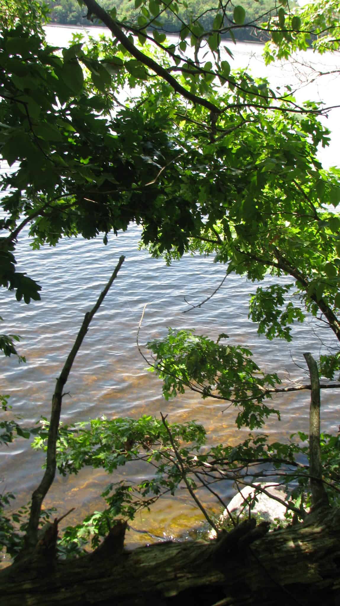
Immediately after the gate, the wide, easy George F. Adams Trail down the “Spine Road” meanders in a vast carpet of Periwinkle (Vinca minor) on the forest floor. The Spine Road continues ½ mile to cross Piazza Lane (an old dirt road), enters Whitehall State Park, and immediately intersects the trail around Lake Whitehall. There is a nice view of the lake through the trees from here, but getting to the shore from this point requires some bushwhacking. The adventurous can walk a 6-mile loop around the lake, which is all within the state park boundary.
There are several side trails along the Spine Road, some designated by small signs on trees:
- The Boat Ramp Trail splits off at two points on the right soon after the gate, that lead you to another side trail to the boat ramp, or across Piazza Lane (a dirt road) to the state park trail. You can also walk down Piazza Lane (private, with permission owner) to the south end of the property where it crosses the main trial near the state park; however it is not as interesting a walk as the main trail.
- Two branches on the left (one of them labeled “Horse Trail”) take you to various points at Reed Park.
- A trail on the right takes you across a former small meadow through a gate to Piazza Lane. Piazza Lane is mostly a private road but hikers are permitted to walk it. However it is more interesting to return and walk down the main trail.
- The Gatehouse Trail on the left, about 0.2 mile from the gate, leads to the state park trail in another 0.15 mile, at a nice lakeside cove.
Do not confuse this property with Whitehall Woods which is off the south end of Lake Whitehall at Pond Street.
Size: 24 acres
Longest Walk: ½ mile one way
Acquired: Conservation Restriction granted 2009
Photo Gallery


History
The town purchased the land in 2006 and in 2009 granted a Conservation Restriction to HALT and Friends of Whitehall, who jointly manage this property. George Adams, whom the trail was named after, was a business man in Woodville who owned most of the conservation area.
This trail was prepared by an Eagle Scout candidate, Erick Pohl as his Public Service Project. Erick also built a 150 foot long fence by the meadow along Piazza Lane, a public/private Road that runs deep into the property and ends at the remains of an old boy scout cabin foundation.
Activities
Biking, Cross Country Skiing, Easy Walking, Hiking/Walking, Horseback Riding, Woods Trail
Additional Information
See map of Whitehall State Park for connecting trails.