Properties

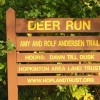
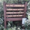
Here is a list of all the HALT properties you might like to visit.  The trail maps accompanying each property description can be used with a smartphone to show your location or to get directions.


Zoom in on the map to separate overlapping property markers 


Size: 43.7 acres
Longest walk:
1.5 miles round trip

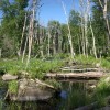
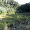
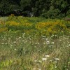
The parcel has a little of everything: a river walk, a wildflower meadow, a cranberry bog, old mill spillways, swamps, vernal pools, open forest, and 30' high glacial moraines.

Directions on Google Maps

Activities: Biking, Bushwhacking, Cross Country Skiing, Hiking/Walking, Vernal Pool, Woods Trail


Size: 15.9 acres
Longest walk:
1 mile round trip including loop

The main trail, accessible to horses, is a one-half mile hiking trail with large beech trees providing a unique landmark.

Directions on Google Maps

Activities: Biking, Easy Walking, Hiking/Walking, Horseback Riding, Vernal Pool, Woods Trail


Cameron Woods

Also known as Sylvan Way, Whisper Way


Size: 126 acres; 250 acres including adjacent town land
Longest walk:
1.8 mile loop on Yellow Trail from Whisper Way, or 2.2 miles from Sylvan Way

Access to over 250 contiguous acres of conservation land and 4 miles of trails.

Directions on Google Maps

Activities: Biking, Cross Country Skiing, Hiking/Walking, Horseback Riding, Hunting, Woods Trail


Size: 68.4 acres
Longest walk:
1.1 miles one way

The 1.1-mile accessible and bicycle-friendly Center Trail is on a former railroad bed, beginning on Main St. directly across from Hopkinton Lumber.

Directions on Google Maps

Activities: Accessible Trails, Biking, Cross Country Skiing, Easy Walking, Hiking/Walking, Vernal Pool


Size: 12.34 acres
Longest walk:
⅔ mile loop + many spurs

This is a hidden treasure at the end of Fawn Ridge Rd. in a sylvan glade that connects to a large network of trails on neighboring properties.

Directions on Google Maps

Activities: Biking, Hiking/Walking


Sandy Beach View
Size: 5.5 acres
Longest walk:
1 mile to top of Peppercorn Hill

This trail provides a scenic route to Upton's Peppercorn Hill along lake Maspenock.

Directions on Google Maps

Activities: Biking, Easy Walking, Hiking/Walking, Sightseeing, Woods Trail


Eagle Farms

Also known as Hopkinton Highlands

Small Stream Crossing near Trailhead
Size: 37.4 acres
Longest walk:
1 mile one way

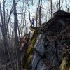
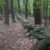
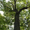
The moderately strenuous one mile long Betty Fitzpatrick Trail travels along steep ridges, past rock outcroppings, through massive stone walls, and alongside a stream.

Directions on Google Maps

Activities: Biking, Hiking/Walking


Fruit Street

Also known as Mary C. O'Brien Pratt Trail

Fruit St. Sign
Size: 145 acres
Longest walk:
5+ miles for all trails

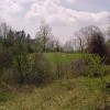
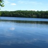
Easy walks or longer hikes through many different habitats and terrain. Up to 5 miles of woods trails, plus another mile of path around the adjacent Town-owned Pratt Farm meadow property. Trails interconnect allowing you to pick your distance and difficulty. Ample parking and plowed in winter!

Directions on Google Maps

Activities: Biking, Cross Country Skiing, Easy Walking, Hiking/Walking, Vernal Pool, Woods Trail


Hopkinton Meadows
Size: 32.5 acres
Longest walk:
1.7 miles round trip

The out-and-back woods trail goes to a pretty meadow with a loop at the end.

Directions on Google Maps

Activities: Biking, Hiking/Walking, Vernal Pool, Woods Trail


Mighton Woods

Also known as North Mill Trail Head


Size: 52 acres
Longest walk:
1.6 miles round trip from either trailhead

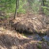
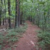
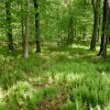
This large property near North Mill and East St. has about 1 mile of trails that cross an intermittent stream and winds through pine, oak and fern forest.

Directions on Google Maps

Activities: Biking, Bushwhacking, Cross Country Skiing, Easy Walking, Hiking/Walking, Woods Trail


Size: 8.4 acres
Longest walk:
0.6 miles round trip

A 0.3-mile out-and-back trail passing by a pair of ponds and through dry open forest, providing a pleasant easy walk any time of year.

Directions on Google Maps

Activities: Biking, Easy Walking


Size: 16.2 acres
Longest walk:
¾ mile one way or 1.6 mile loop

Beautiful forest along marshes at the headwaters of Cold Spring Brook, connecting to trails at Legacy Farms.

Directions on Google Maps

Activities: Biking, Bushwhacking, Cross Country Skiing, Easy Walking, Hiking/Walking, Vernal Pool


Size: 7.3 acres
Longest walk:
½ mile from Sylvan Way to Winter St.

The short trail on this property provides a connection between Winter Street, Whitehall State Park and Cameron Woods, and is a pleasant walk in its own right.

Directions on Google Maps

Activities: Biking, Easy Walking, Hiking/Walking, Hunting, Sightseeing, Woods Trail


Goldenrod, Black-Eyed Susan and Queen Anne's Lace
Size: 25 acres in Hopkinton
Longest walk:
1.2 miles to the summit of Peppercorn Hill

This easy trail provides access to the summit of Peppercorn Hill in 1.2 miles.

Directions on Google Maps

Activities: Biking, Easy Walking, Hiking/Walking, Sightseeing, Woods Trail


Sands Conservation Area

Also known as Douglas Sands Trail


Size: 74 acres
Longest walk:
4 miles

The Douglas Sands Memorial Trail is along a wooded ridge that overlooks a deep ravine. The Greenwood Trail provides a loop of nearly 4 miles.

Directions on Google Maps

Activities: Biking, Cross Country Skiing, Hiking/Walking, Woods Trail


Size: 35 acres

A large property with a number of unmarked trails.

Directions on Google Maps

Activities: Bushwhacking


Lake Whitehall
Size: 24 acres
Longest walk:
½ mile one way

One of the most popular and easily accessed properties in Hopkinton, with multiple connections to Whitehall State Park.

Directions on Google Maps

Activities: Biking, Cross Country Skiing, Easy Walking, Hiking/Walking, Horseback Riding, Woods Trail


Size: 32.5 acres
Longest walk:
1 mile round trip

The trail at Whitehall Woods provides access from Pond Street at the south end of Whitehall State Park to a large network of trails in Upton State Forest.

Directions on Google Maps

Activities: Biking, Cross Country Skiing, Easy Walking, Hiking/Walking, Horseback Riding, Vernal Pool, Woods Trail


Size: 15.9 acres
Longest walk:
¾ mile round trip

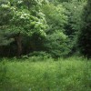
This property has a ¾ mile round trip trail through diverse forest, and can be walked in conjunction with the neighboring trail at the Brook Hollow Conservation Area.

Directions on Google Maps

Activities: Biking, Cross Country Skiing, Easy Walking, Hiking/Walking, Horseback Riding, Vernal Pool, Woods Trail


Size: ½ acre

A small park-like setting with benches and beautiful views to the west.

Directions on Google Maps

Activities: Sightseeing


Size: 8.3 acres

This property on Wilson Street was gifted to HALT but is open only to residents.

Directions on Google Maps

Activities: Hiking/Walking