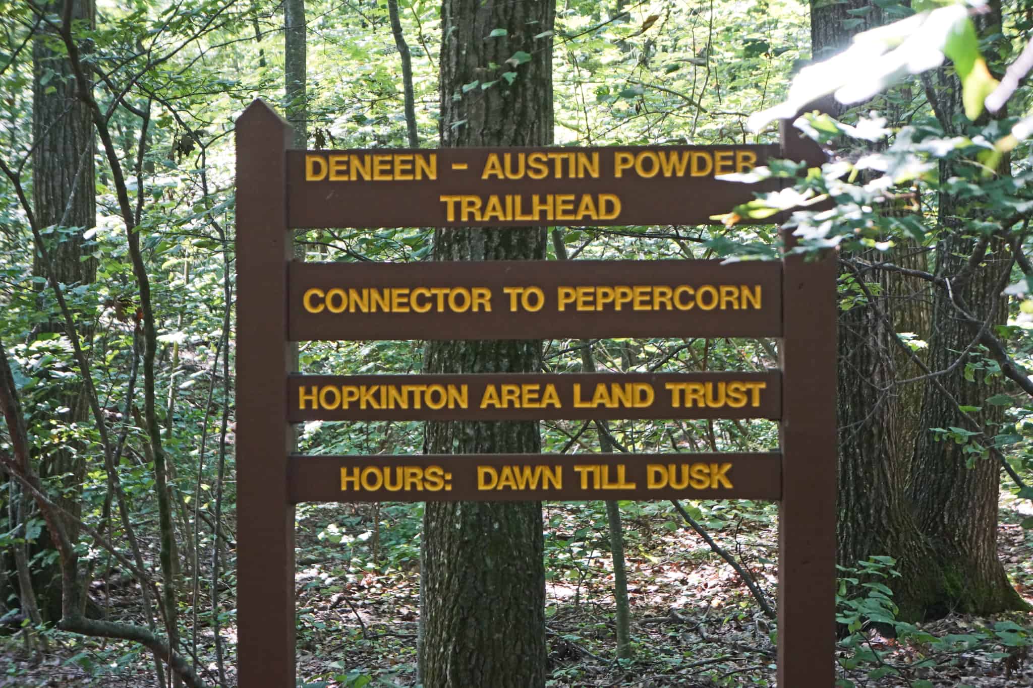
Deneen Conservation Area
Location
Map Legend


Directions
The main trailhead, and graveled parking for a couple of cars, is at the beginning of the driveway off Deneen Road exactly opposite Scarlata Road. Please do not drive further down the private driveway.
Another entrance is off Scarlata Road just south of Oakhurst.
Overview
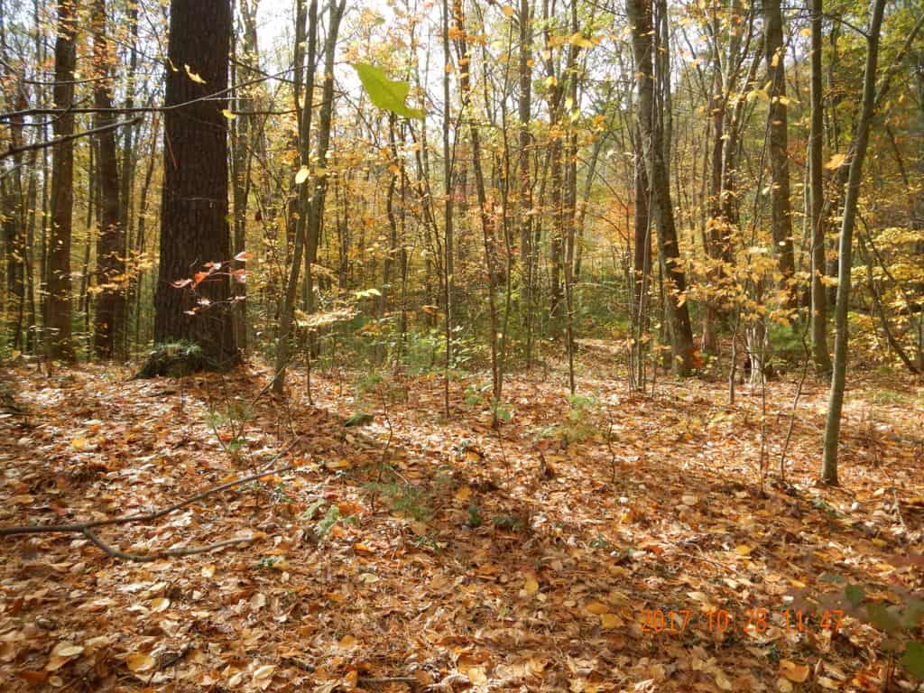
This property has one of two trailheads from Hopkinton to Upton’s Peppercorn Hill. (The other is at Rockwood Meadows.) They are much less used and not as badly eroded as the trail from Crockett Road on the Upton side of the hill.
There are two entrances. The main trail starts at the parking area behind the large sign on the left side of the driveway and continues parallel to the driveway just a few feet away. Almost immediately you will get to a mowed path across the trail, but keep going straight. It can sometimes be too overgrown to go straight, so instead you can turn right on the mowed path and walk down the driveway a little bit until you see a way to get back to the trail on your left.
In about 200 feet from the trailhead, which is at the same point you returned to the trail if you walked down the driveway, you will encounter a signpost to Peppercorn Connector. Here is where the trail splits. The Peppercorn Connector Trail to the right across the driveway connects to Upton’s Walleston Trail and to Peppercorn Hill by a gentle high route. Do not walk further down the driveway.
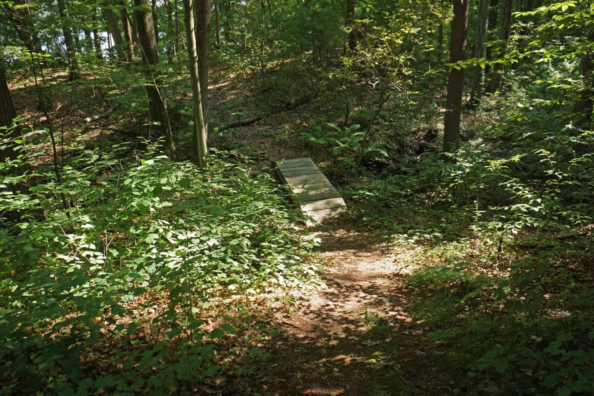
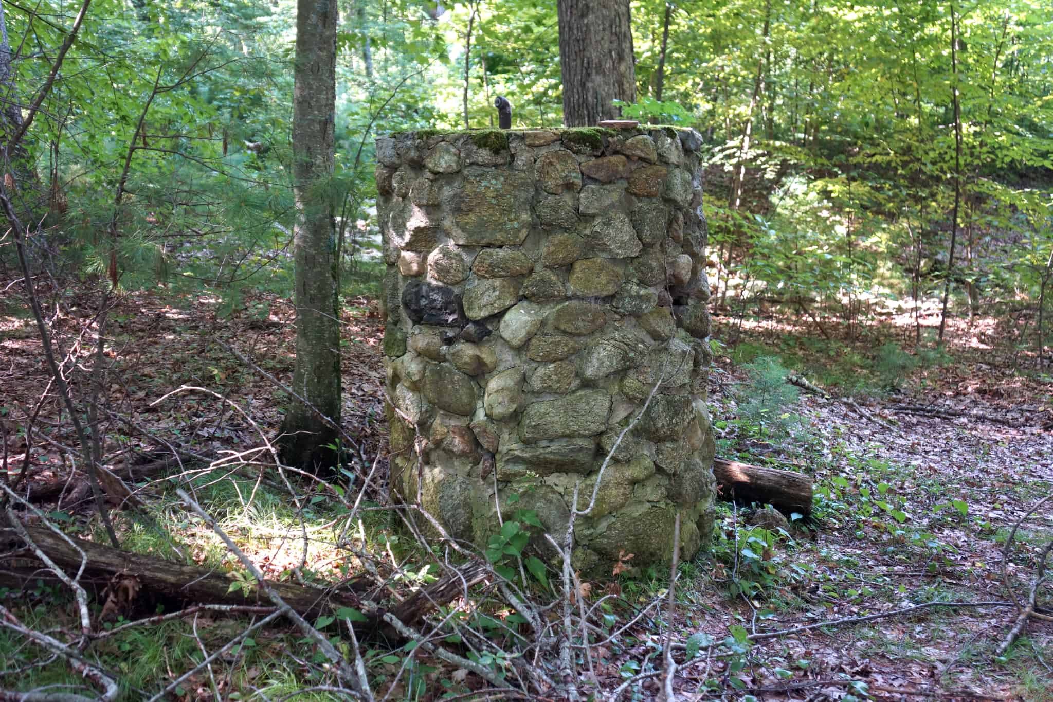
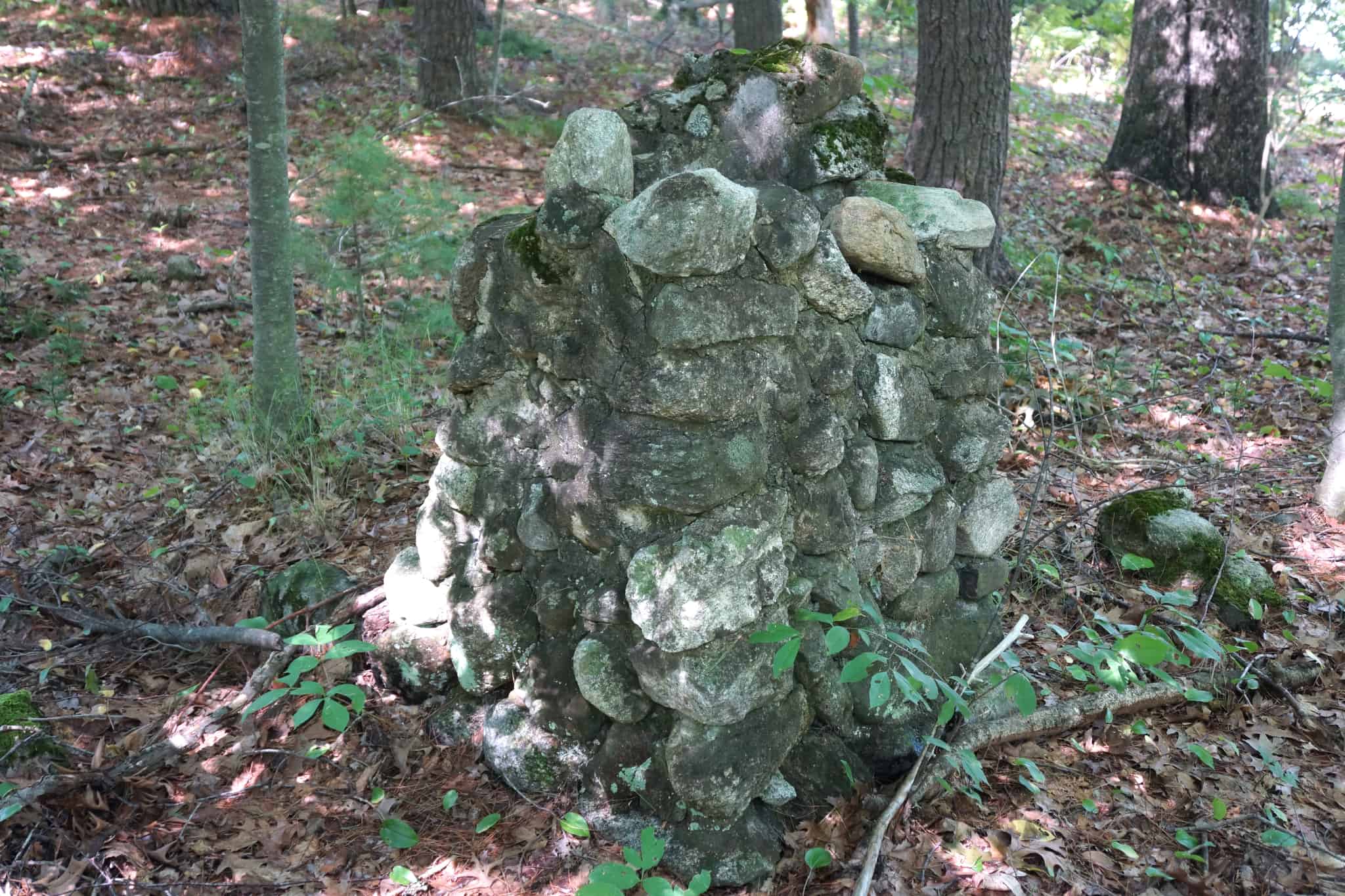
Instead of turning right across the driveway, you can stay on the Lake Maspenock Trail by going straight in the woods at the signpost, to get to Peppercorn Hill by a beautiful walk near the shore of Lake Maspenock. This lower route is more scenic and slightly shorter, but then gets very steep. Along the way, before nearing the lake, you will see the remains of an old still on your left. Step up and look inside it to see the piping. Immediately after the still is an old chimney with a fireplace, and then the trail heads down closer to the lake after crossing a bridge. Soon you will see Sandy Beach across the lake, at first through the trees but with a couple of nice viewpoints off short spurs further south.
As the trail turns away from the lake it crosses the Upton town line and becomes quite steep, which can be slippery in winter with a thin layer of snow. Here you are ascending the slope of Peppercorn Hill. The trail levels off as you get to the ridge, where it joins the Walleston Trail to the summit of the hill. From this intersection you can turn right instead and head back down to the trailhead via the Peppercorn Connector Trail.
The Deneen Conservation Area only extends about 1500′ from the start of the driveway. Getting to the shore of Lake Maspenock or the top of Peppercorn Hill by either route involves crossing private land, so please stay on established trails until you reach Upton Conservation Land or the Peppercorn Hill Conservation Area. The top of the hill is about 1 mile from the trailhead.
Another trail starts at the Scarlata Road trailhead (park along the side of the road) and goes through a narrow strip of woods, that opens up into hilly area, crosses a stream on rocks, and eventually comes to an old well-worn cart path. You can make a loop by walking down the cart path several hundred feet to a point where a side trail exits left and takes you around a loop, crossing some potentially wet areas, and returns you to the cart path. From a point on this loop you can go south to a fork. Take the right fork to go up Peppercorn Hill, or the left fork to go to the Lake Maspenock Trail or return back to the main parking lot.
Size: 5.5 acres
Longest Walk: 1 mile to top of Peppercorn Hill
Photo Gallery


History
The eastern portion of this property, which is on both sides of the driveway, was gifted to HALT by Jean Scarlata and family. Jean is a lifelong Hopkinton resident. The west side of Lake Maspenock and Oakhurst Road was originally developed by the Deneen family.
The western portion of the property was donated to HALT in 2014 by the Austin Powder Company of Ohio, as excess property they wanted to dispose of. It was landlocked but conveniently abutted the Deneen property.
The name Maspenock comes from the Nipmuc dialect of eastern Algonquin, and is written as Massibenokik, which means “the waters at the base of the great hill”, a direct reference to the steep rise of Peppercorn Hill on the shoreline in Upton.
Activities
Biking, Easy Walking, Hiking/Walking, Sightseeing, Woods Trail