Fruit Street
Also known as Mary C. O'Brien Pratt Trail
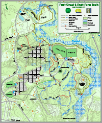
Location
Map Legend


Directions
The main trails are accessible from the access road to the Fruit St. athletic fields. The Mary Pratt South trail, blazed with blue arrow signs, has two trailheads. One entrance is at the far left corner of the gravel “overflow” lot along the left side of the access road to the athletic fields (follow arrows). The other entrance is on the right side of the access road to the Waste Water Treatment Facility just a little beyond the main parking area for the fields where there is a large sign. There are large signs at both entrances. The Mary Pratt North trail, blazed with white arrow signs, also has a trailhead at the gravel overflow parking area and is marked by a large sign. You can also park in the main parking for the athletic fields and cross the fields to connect to the trail. The north trail can also be accessed from a parking area on a short spur road off of Fruit Street. Park in front of the gate at the end of the spur. The Whitehall Brook Trail, blazed with yellow arrow signs, has one end in the Pratt Farm area and another at the Mary Pratt South Trail. It can be entered near its middle, from the road to the treatment facility opposite the Mary Pratt South trailhead, or from one of the two east corners of the athletic fields. These connector trails are all blazed with orange arrow signs. Parking for the the grassy Pratt Farm trails is in a lot directly off Fruit St. by a kiosk.
Overview
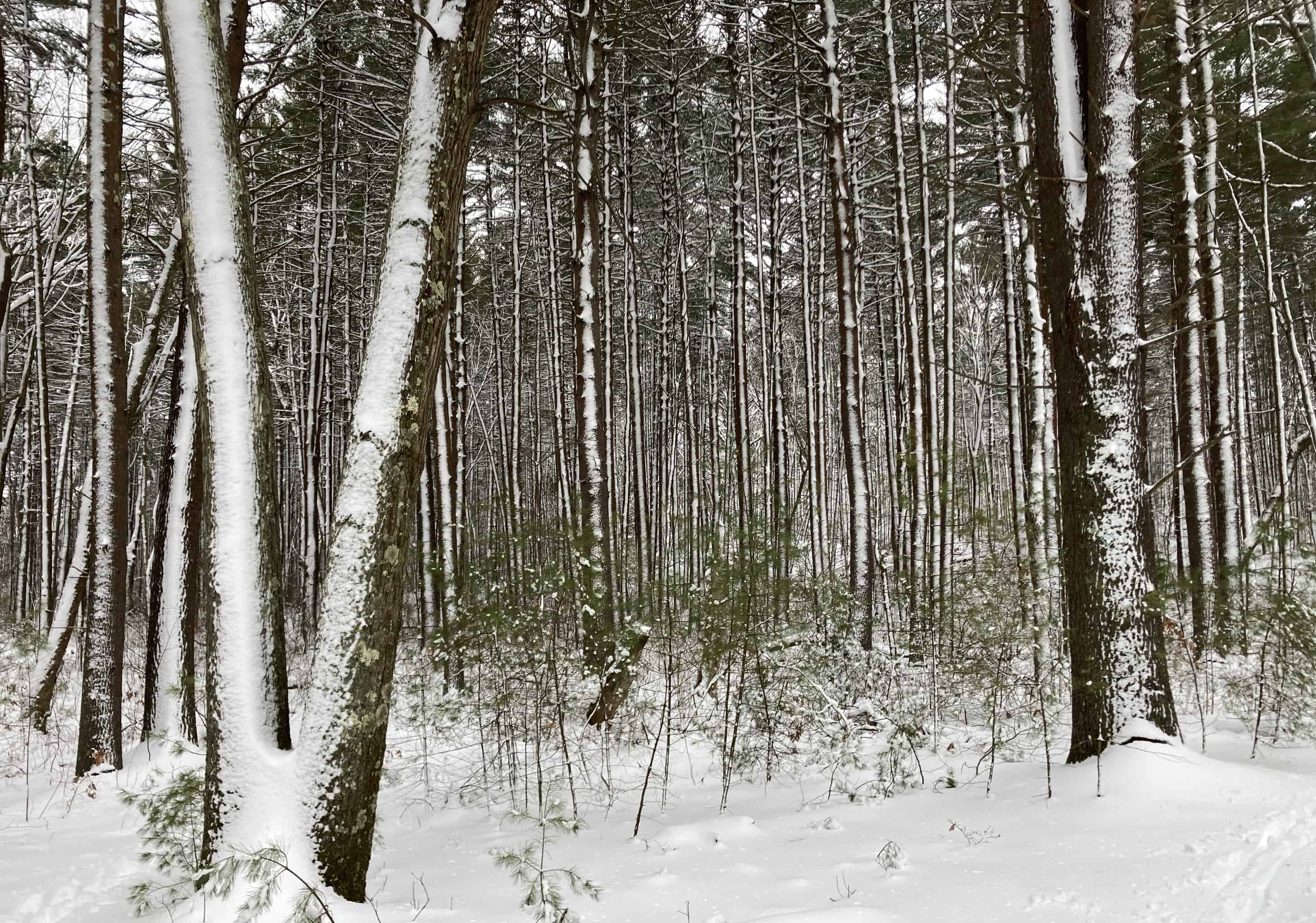
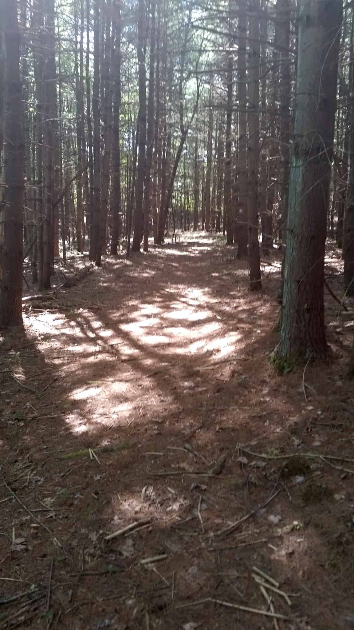
 The Fruit Street and adjacent Pratt Farm properties provide almost 290 acres of Town of Hopkinton public land, of which 145 acres is conservation-restricted land managed by HALT. They contain over 6 miles of woods and field trails accessible from the access road to the athletic fields and parking areas off of Fruit Street. The Fruit Street, trails are divided into three general areas, all linked, allowing for a grand circuit of about 3 miles, or 4 miles if the Pratt Farm trails are included. Fruit St. and Pratt Farm are unusual in the town’s open space in that most of the trails are mostly stone-free allowing cross country skiing with relatively little snow cover. Skier signs mark more skier-friendly routes around steeper curving areas. The area is also has examples of features of the glacial retreat, including several kettle holes and an esker. Current ecological changes are also evident in the impact of several beaver dams.
There are three main named trails, White, Blue, and Yellow on the map and trail markers. Also on the trails, Red trails are links, and Orange trails lead to parking or access areas.
The Mary Pratt Trail South Trail (Blue) provides both easy walking and some steeper slopes and higher hills. The area includes several different habitats including upland hardwood forest, several White Pine stands, wetlands and vernal pools. Please note that the trail to the south eventually leads to the private land of the Woodville Rod and Gun Club, where there is a firing range. Please turn around at the signs and do not enter that property. The western loop is not recommended for novice X/C skiers due to some large stones and steeper slopes. There are several connector trails, blazed with red arrow signs, that provide shortcuts across parts of the Mary Pratt South Trail.
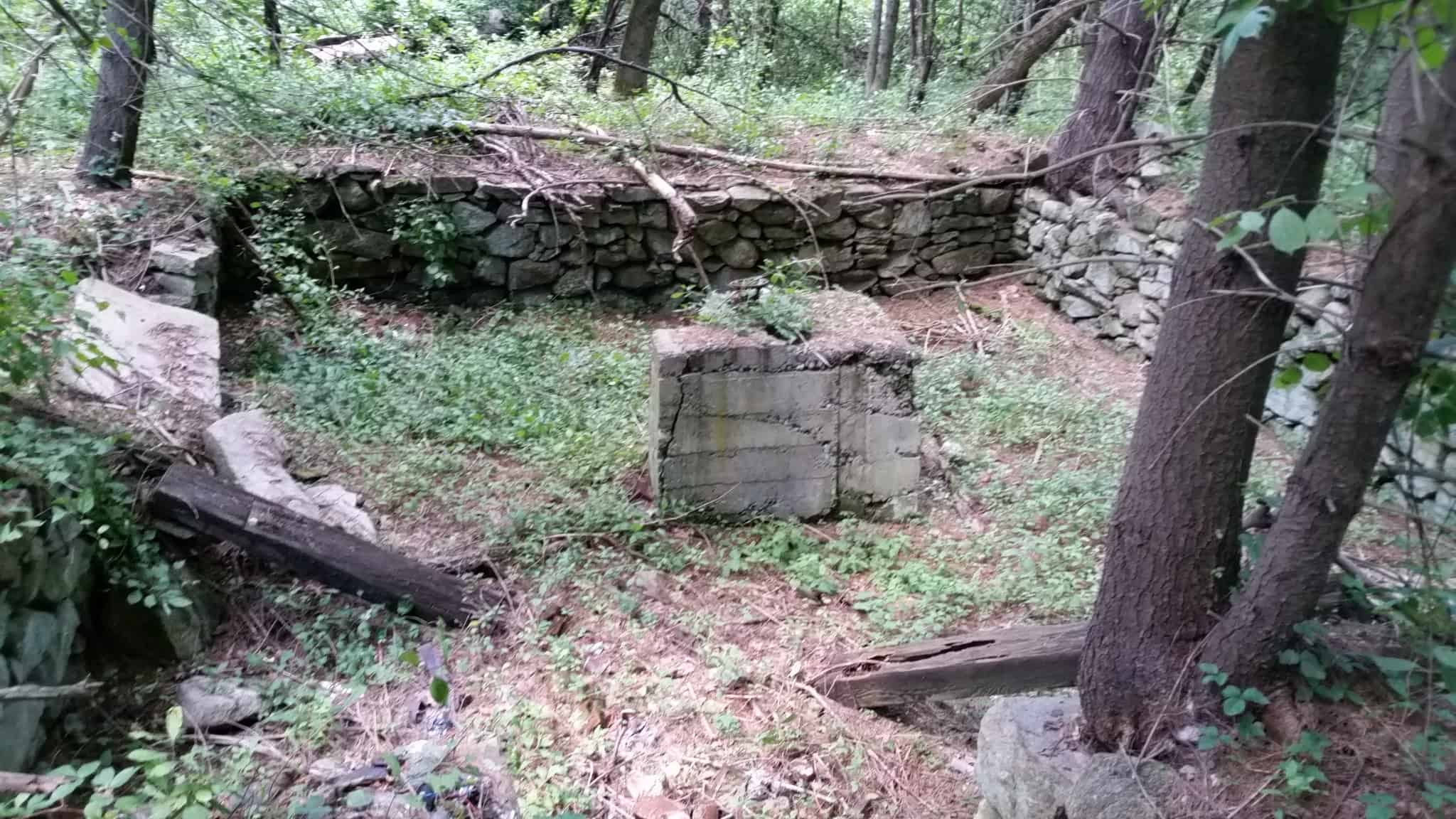
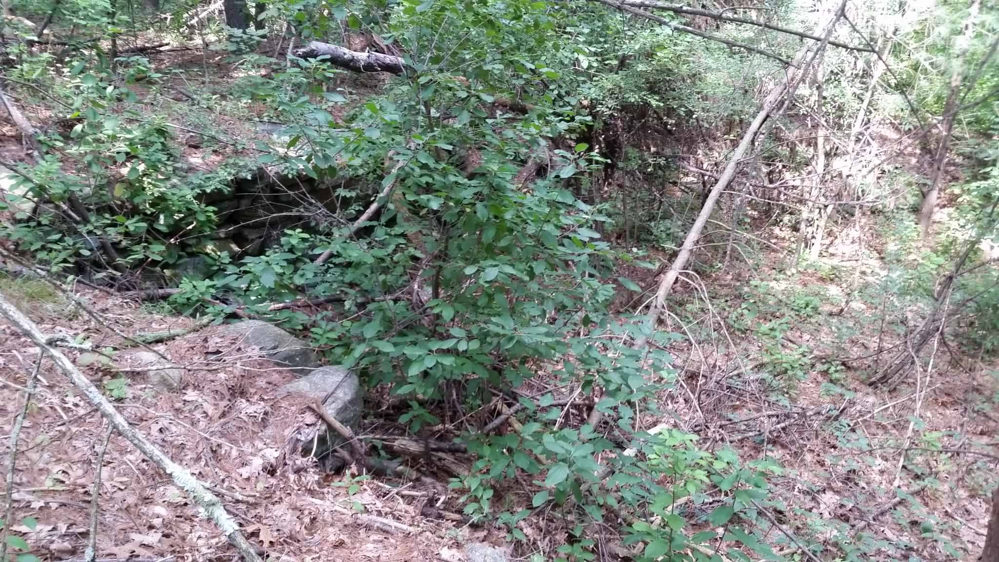
The Mary Pratt Trail North Trail (White) also encompasses a variety of habitats and provides mostly easy walking except for a few short steeper sections. Points of interest along the way are vernal pools, a large wetland, an old gravel pit undergoing natural succession back to grasses, and a pine forest. Along the trails, see if you can spot two old stone foundations and a large pine tree growing in the middle of a tire along the way. As you walk the trails, appreciate how the forest can recover from past disturbance. Old piles and excavations testify to a history of disturbance, but many of those areas now support sizable white pines. With white pines you can estimate the age by counting whorls of branches: each whorl is a year. The trail system also connects to the Town’s Pratt Farm meadow.
The Whitehall Brook Trail (Yellow) provides a walk near Whitehall Brook and bordering wetlands for most of its length, with many views of Whitehall Brook. You can enter that trail from the Mary Pratt South Trail or Pratt Farm, or via connecting links from the access road to the sewage treatment facility, or the northeast or southeast corners of the athletic fields. The trail is blazed with yellow arrow signs, and the connectors to it are blazed in orange. West of the sewage treatment field, the trail follows the top of a geologic feature, a small ridge known as an “esker” formed buy deposits from a stream flowing under the melting glacier. At the south end of the esker, you get a view of a low beaver dam on Whitehall Brook. Along the higher ground on the east side of the trail system are more views of Whitehall Brook and its wetlands. Great waterfowl habitat!
As you walk, just imagine that the sound you hear is not I-495, but the sound of rapids in Whitehall Brook. And consider how open space preservation is critical even close to intensive human use.
Watch the HCAM-TV “What’s Out There” video on Fruit Street trails.
Size: 145 acres
Longest Walk: 5+ miles for all trails
Photo Gallery


History
The Fruit Street property began life as the Pyne Sand & Gravel Operation and consisted of 245 acres of prime land that produced gravel for the local area for many years. Jim Pyne offered the property to the Town and the Town eventually purchased the property. Master planning of the property was undertaken and included sports fields, well sites, affordable housing, a public works facility, a waste water treatment facility, market rate housing, a school facility, and open space. To date the Waste Water Treatment Facility, the sports fields and use by the Public Works department of the old Pyne buildings, and a well site are the only uses. Eventually the Town placed a Conservation Restriction on 145 acres of the property outside the athletic fields and roads, co-held by the Trust and the Sudbury Valley Trustees. The Trust prepared the northern section of the southern trail with the aid of Sam Darkow, as an Eagle Scout Public Service Project. The northern trail is a combination of old roads and clearing by Scouts. The trails are dedicated to Mary Pratt, who devoted many years of service to the town and is one of the five founders of the Hopkinton Area Land Trust. The trail network has significantly expanded in 2020-21 with extensions to the Mary Pratt trails, construction of the Whitehall Brook Trail, several connecting links, and clearing of trails in the Pratt Farm area.
Activities
Biking, Cross Country Skiing, Easy Walking, Hiking/Walking, Vernal Pool, Woods Trail